
 By Joe Sale · Photographer & fine artist · Reviewed and updated October 2026
Clearwater drone photography has an unfair advantage: few places look better from a few hundred feet up. Turquoise Gulf water, a ribbon of white sand, the causeway stretching across the harbor and a downtown skyline on the mainland all fit in a single frame. Joe Sale, a Tampa Bay photographer and fine artist, flies a DJI drone that captures high resolution stills and 4K video of exactly that kind of scene.
The geography does a lot of the work. Clearwater Beach sits on a barrier island, Clearwater Harbor separates it from the mainland, and the Memorial Causeway links the two. Sand Key runs south along the Gulf. From above, those pieces read as one connected coastline, which is why Clearwater drone photography is so useful for anyone selling a location rather than just a building.
This page covers who uses aerials, how flights are planned around wind and airspace, and what you receive at the end.
Clearwater drone photography from Joe Sale delivers aerial stills and 4K video for real estate, hotels, restaurants, events and brand campaigns. Every flight is planned under FAA Part 107 rules with airspace and weather checked in advance, timed for calm air and good light, and delivered in a private gallery sized for web, social and print.
What Aerials Reveal That Ground Photos Miss
Buyers, guests and attendees all ask the same first question about a coastal place: where exactly is it, and what is around it? A good aerial answers that in a glance.
A ground photo tells you what a place looks like up close. An aerial tells you where it is and what surrounds it. For a waterfront property, that difference can be the whole story.
- Distance to the water: how many steps from the pool deck to the sand, or from the dock to open harbor.
- The shape of the land: a lot's boundaries, a building's footprint, how a marina's slips are arranged.
- Neighborhood context: proximity to the beach, the causeway, downtown and the barrier islands.
- Scale: how big a crowd, a venue or a project really is when seen whole.
- Color: Gulf water shifts from pale green over sandbars to deeper blue offshore, and only the overhead view shows that gradient clearly.
Clearwater drone photography is strongest when it works alongside ground images rather than replacing them. Joe photographs both, so the overhead view and the interior shots share the same color and style. His aerial and drone service page explains the full offering.
It also helps to know what aerials do not do well. Faces are too small to read from the air, so people-focused work belongs on the ground. Interiors obviously need a camera inside. And a drone image of a plain parking lot is still a parking lot. Joe will tell you honestly when an aerial adds something and when your budget of time is better spent elsewhere.
Who Hires Clearwater Drone Photography, and What They Need
Different clients want very different things from the same aircraft. This is how the main groups usually break down.
| Client | What the aerial shows | Typical deliverable |
|---|---|---|
| Real estate agents and sellers | Lot, roofline, water access, neighborhood | Stills for listings, a short video flyover |
| Hotels and resorts | The property against the beach and Gulf | Hero images for websites, video for social |
| Restaurants and bars | Waterfront location, outdoor seating, sunsets | Social clips and a few signature stills |
| Event organizers | Crowd size, layout, stage and venue | Recap video and wide establishing shots |
| Brands and agencies | Product or campaign in a Gulf coast setting | Campaign stills and 4K footage |
The table is a guide, not a menu. A charter boat company might want the vessel tracked across the harbor at sunset; a contractor might want progress views of a project over several months from the same angle. Clearwater drone photography adapts to the story, and the planning call is where that story gets defined.
Real estate is the most common request, and Joe treats listings as architecture: straight verticals, balanced exposure, and aerial angles that answer the buyer's real questions. For property work across the region, see the St. Petersburg real estate photographer page and his brand and commercial work.
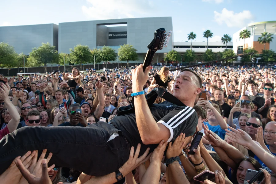
Event work comes with its own planning. Festivals, races and waterfront celebrations draw crowds, and flights over people are avoided, so Joe positions the drone to capture the scale of the event from the edges or before gates open. Combined with his ground coverage of concerts, festivals and events, the result is a recap that shows both the energy up front and the size of the whole site.
Airspace and Part 107 Near the Airport
Commercial drone work in the US falls under FAA Part 107 rules. Those rules cover how high a drone may fly, keeping it within sight, avoiding flights over people and checking airspace before takeoff. Joe plans every flight around them.
Clearwater adds a local wrinkle. St. Pete-Clearwater International Airport sits across the county on the bay side, and parts of Pinellas County fall within controlled airspace. Some locations need advance authorization before a flight; others may have limits on height. Beaches and parks can also carry their own local rules, and state parks set their own policies on drones.
What this means for you
- Share the exact address or location early so airspace can be checked before scheduling.
- Expect Joe to suggest an alternative vantage point if a spot is restricted.
- Busy beach days may limit where the drone can launch and fly, since flights over crowds are avoided.
- Safety calls happen on site. If conditions change, the drone stays on the ground.
- Bird activity along the beach and harbor is watched too, and the drone keeps its distance from wildlife.
Joe does not claim any special status beyond following the rules carefully. What he offers is planning: checking the map, the restrictions and the weather in advance so your shoot day is not spent discovering problems on site.
Good Clearwater drone photography starts with this homework, long before any propellers spin.
Picking the Flight Window: Wind, Sea Breeze and Water Color
Weather on the coast changes fast, and the drone feels it before you do. A breeze that barely moves your hair at the waterline can be much stronger a few hundred feet up, where there are no buildings or trees to slow it down. Joe watches three things when choosing a time.
Wind
Gulf breezes pick up through the day as the land heats. Early morning is often the calmest window, which means steadier video and sharper stills. Afternoon wind off the water can be strong enough to ground a flight even on a sunny day.
Clouds and storms
Summer afternoons frequently bring thunderstorms that build inland and push toward the coast. Morning flights dodge most of them; evening flights sometimes catch dramatic skies as storms clear. Joe checks the forecast and radar the day before and the day of.
Light on the water
Temperature matters too. On hot summer days, heat shimmer over pavement and sand can soften long views, and batteries drain faster. Cooler, drier months often give crisper distance and a little more flight time per battery, which makes winter a quietly excellent season for Clearwater drone photography.
The clearest view of sandbars and shallow water color usually comes when the sun is higher, while sunrise and sunset paint the sky and soften shadows on buildings. Many projects mix the two: a midmorning flight for clean color and a sunset flight for mood. Joe's own shutter-drag Gulf sunsets show how much the last light can change a scene.
Tides affect the picture as well. Lower water can expose more sandbars and give that classic patchwork of greens and blues, while higher water makes the shoreline look fuller. If water color is central to your project, Joe will look at the tide table along with the forecast.
Planning aerial coverage? Commercial drone flights in the United States fall under the FAA's Part 107 rules for commercial operators, and Joe checks the National Weather Service Tampa Bay forecast for wind and storms before every flight.
Stills, 4K Video or Both?
The DJI drone Joe flies records 4K video and high resolution stills on every flight. Choosing what to emphasize depends on where the work will be seen.
- Stills work best for listings, websites, print materials and press. A single strong aerial can carry a homepage.
- Video shines on social media and in presentations: a slow push toward a hotel, a reveal of the beach from behind a building, a tracking shot along the causeway.
- Both is usually the smart choice for hospitality and events, since capturing extra footage takes little additional time once the drone is already up.
For video, Joe plans moves the way a filmmaker would: slow, deliberate motion that holds a subject in frame, steady reveals and a few top-down shots for variety. Fast, swooping flying looks exciting for three seconds and then tires viewers, so he saves it for moments that earn it. Clips are kept short and usable, so an editor or social manager can drop them straight into a reel.
Joe also shoots ground stills with Nikon bodies, including the D5 and D6, and lenses from the 14-24mm f/2.8 for wide interiors to the 80-400mm for distant details, so an aerial project can include the views from the deck, the lobby and the dock. Ask about pairing flights with headshots and personal branding of the owner or team for a complete marketing set.
A Clearwater Drone Photography Flight Day, Step by Step
Here is how a typical project runs from first conversation to delivered files.
- Planning call. Joe asks about the property or event, the shots you need and where they will be used. You can start this from the booking page.
- Airspace and site check. Location, nearby airspace, launch points and any local restrictions are reviewed.
- Shot list. Specific angles, heights and moves are written down, with a backup plan for wind.
- Weather call. The day before, Joe confirms or reschedules based on the forecast.
- Flight. On site, he does a safety check, flies the shot list and captures extras when the light cooperates.
- Edit and delivery. Color is balanced across stills and video, and files arrive in a private online gallery sized for web, social and print.
On site, the actual time in the air is often shorter than people expect. Batteries limit each flight, so Joe works through the shot list in order of priority and keeps spare batteries ready. The most important angle goes first, in the best light, and extras follow if conditions hold.
Everything stays organized for the people who will use it. Stills are grouped by angle and use, video clips are labeled, and file sizes fit their destination, so a listing agent, web designer or social manager can grab what they need without digging.
Most people never see steps two through four, but they are why Clearwater drone photography looks effortless when it is done well.
Aerials Joe Has Already Flown Around Tampa Bay
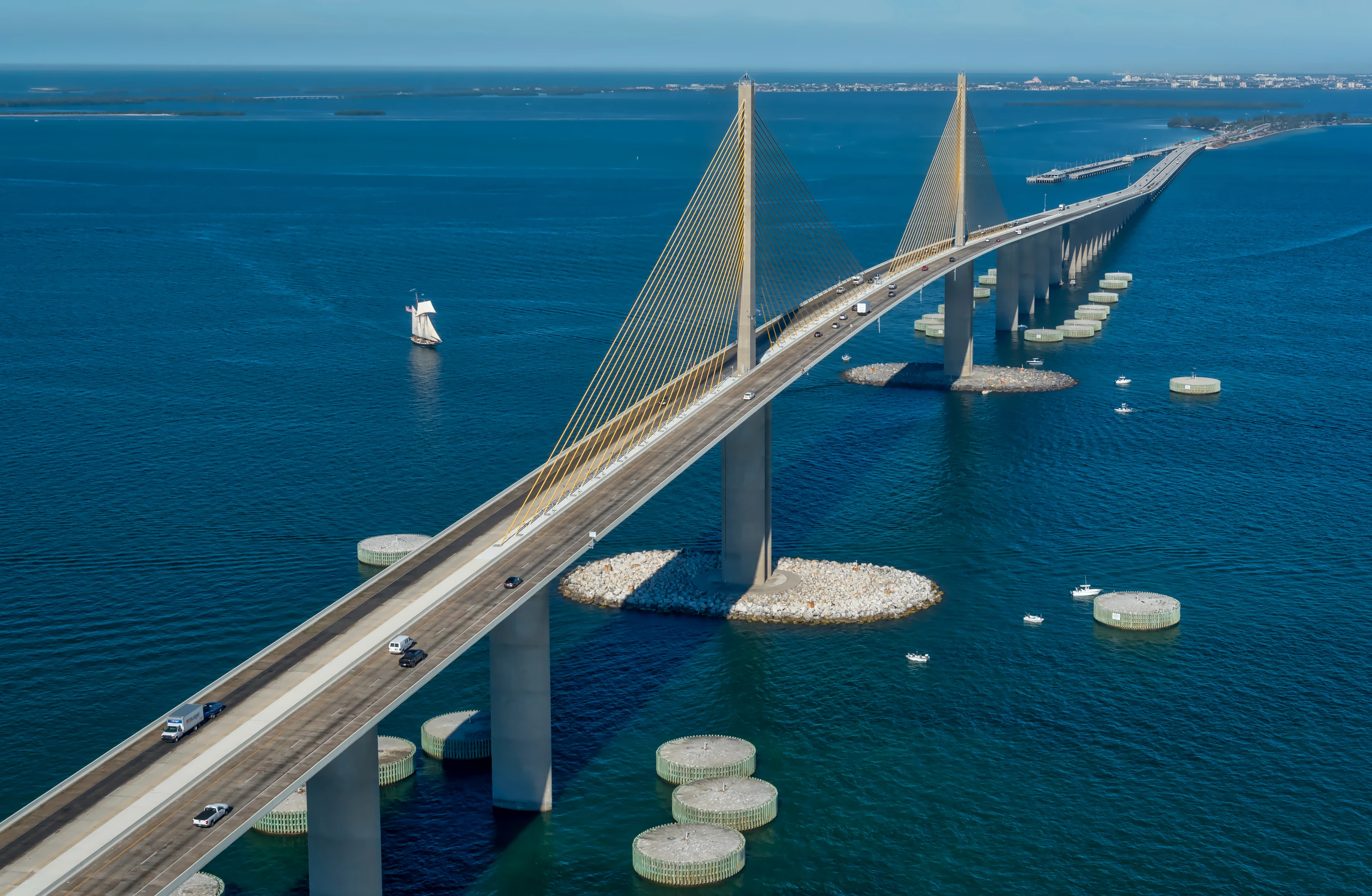
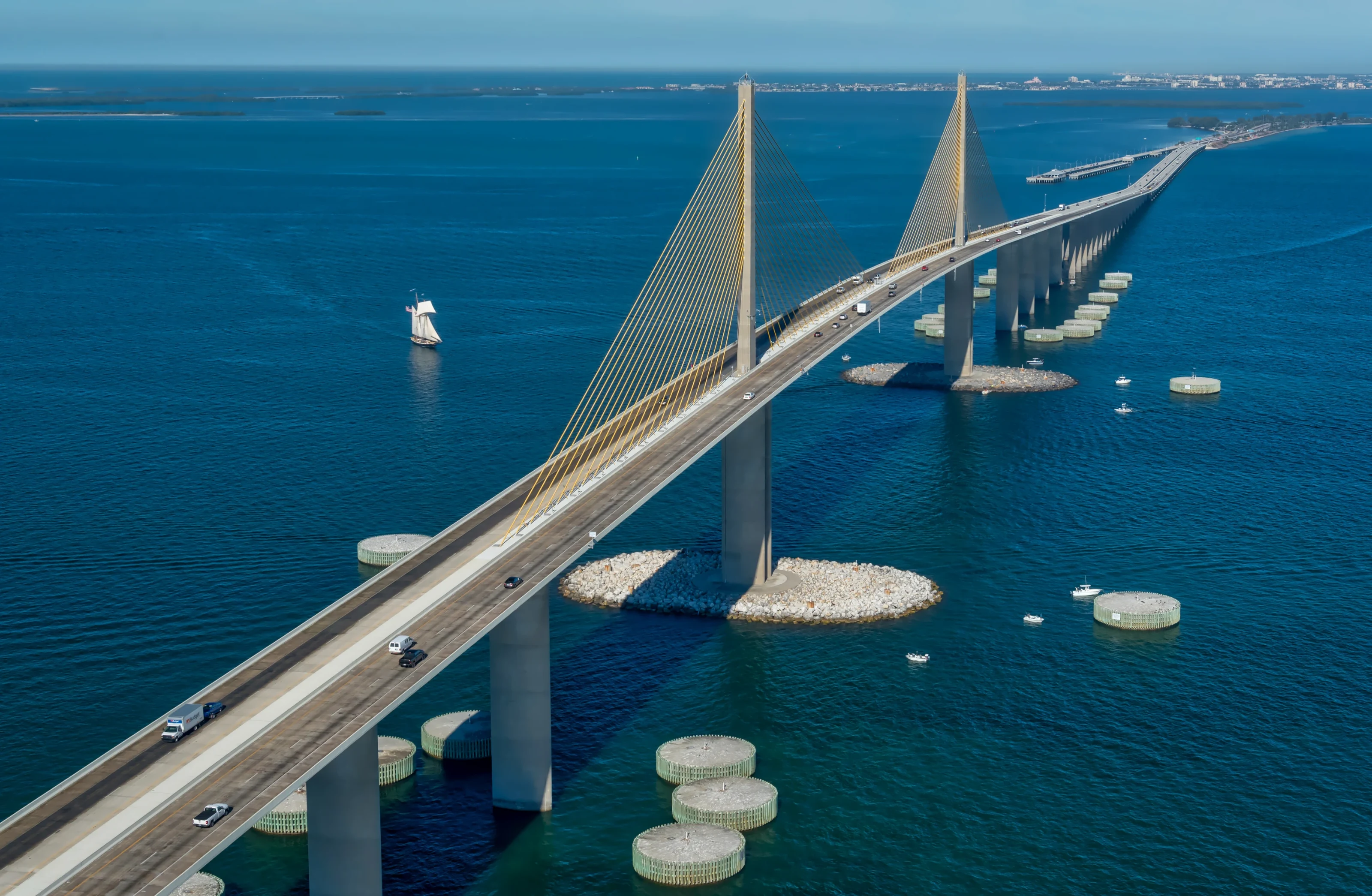
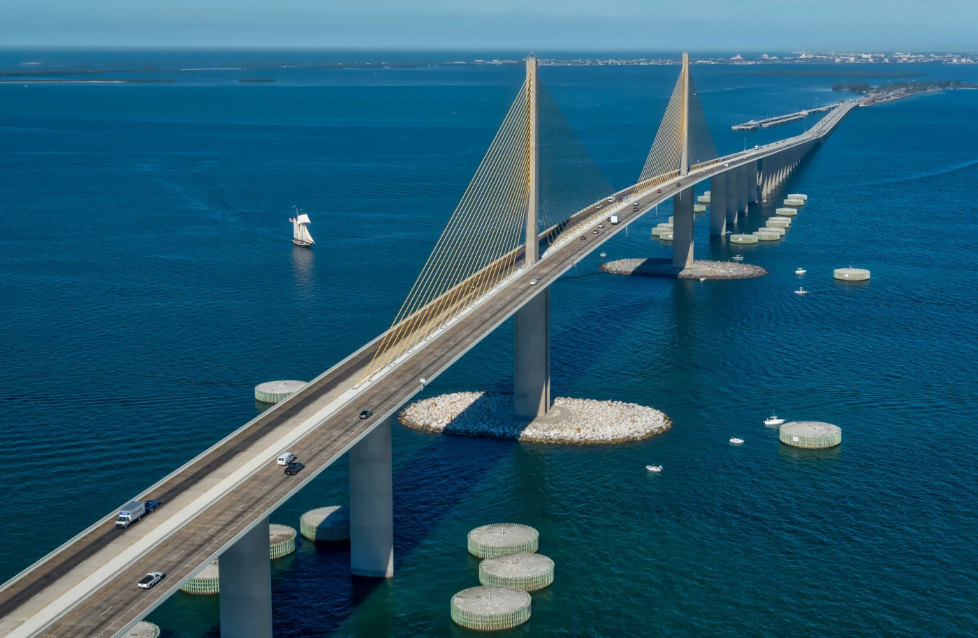
Joe's aerial portfolio covers some of the most recognizable views in the region. He has photographed the Sunshine Skyway from the air, flown over downtown Tampa, and captured footage of St. Pete Beach by the Don CeSar. Each one shows a slightly different problem solved: the scale of a bridge, the density of a skyline, the pink of a landmark hotel against blue water.
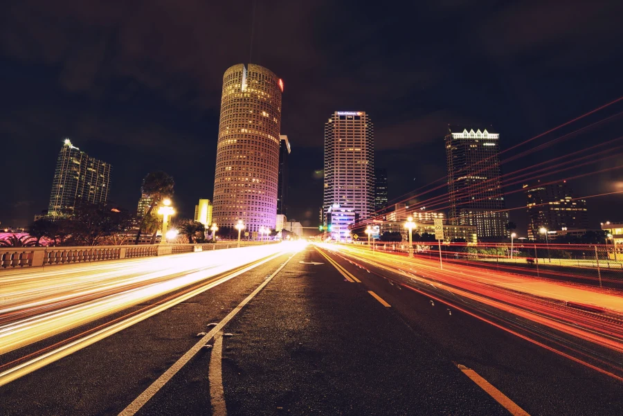
He brings an artist's eye to aerial work as much as a technician's. The same instinct that produces long-exposure light trails over downtown Tampa and a blue hour panorama of the skyline over the Hillsborough River shapes how he frames a coastline from above: looking for lines, rhythm and a moment of light that turns a record shot into an image someone wants on a wall.
Those projects inform how he approaches Clearwater, which combines all three: a long causeway across the harbor, a mainland downtown and a beach lined with hotels. You can see the range in his portfolio, and some of his Tampa Bay views are available as limited fine art prints.
Clearwater drone photography also benefits from Joe's habit of scouting before he flies. He looks at the location from the ground first, notes power lines, palms, rooftops and launch spots, and only then plans the moves. That small investment of time is what keeps the flight smooth and the shot list on schedule.
Clients who want aerials elsewhere in Pinellas can compare St. Pete drone photography, and Hillsborough projects are covered on the Tampa drone photography page.
Booking Clearwater Drone Photography With Joe
Before you call, it helps to gather a few details: the address or event location, how you plan to use the images, any brand guidelines, and dates that work. With that in hand, the planning call is quick and the airspace check can start right away.
Give yourself some flexibility. Coastal weather means a flight may move by a day, so it helps to have a window rather than a single fixed date, especially in summer. For real estate, schedule the drone after landscaping is fresh and the pool is clean; for events, share the run of show so Joe can be airborne at the key moments.
Hotels and restaurants often want aerials tied to a season or a launch, so give Joe as much lead time as you can. That makes it easier to line up calm weather, good light and any airspace authorization the site needs. Planning Clearwater drone photography around a deadline is fine; planning it around a single morning with no backup is risky.
Call or text 813-417-2626, or start on the booking page. For more about Joe's work across the city, visit the Clearwater photographer page or the Clearwater Beach photographer guide.
Clearwater Drone Photography: Frequently Asked Questions
Do you need permission to fly a drone in Clearwater?
Commercial drone work in the US falls under FAA Part 107 rules, and parts of Pinellas County sit in controlled airspace near St. Pete-Clearwater International Airport, which can require advance authorization. Local parks and beaches may have their own rules too. Joe checks airspace and site restrictions for every location before scheduling a flight.
What is the best time of day for drone photos at the beach?
Early morning usually offers the calmest wind and fewest people on the sand, which makes for steady video and clean frames. Midmorning sun shows off water color over the sandbars, while sunset gives dramatic skies. Joe often recommends combining two windows for a project that needs both clarity and mood.
Can drone flights happen in windy or rainy weather?
Not safely. Strong gusts off the Gulf affect stability and image sharpness, and rain or nearby lightning grounds any flight. Joe checks the forecast and radar the day before and on the morning of the shoot, and he will move the flight to the next good window rather than deliver weak results. A short delay is almost always worth it for steady footage.
Is drone video delivered in 4K?
Yes. Joe's DJI drone records 4K video along with high resolution stills, so you can use the footage for websites, social media and presentations. Files are color balanced to match any ground photography from the same project and delivered in a private online gallery sized for web, social and print. Stills arrive alongside the clips.
Can aerial and ground photography be booked together?
Yes, and it is usually the better approach. Pairing aerials with interiors, exteriors, team portraits or event coverage keeps the whole set consistent in color and style. Joe plans the order on the planning call so the drone flies in the calmest air and ground shots happen in the best available light.

About Joe SaleJoe is a Tampa Bay photographer and fine artist who shoots portraits, live music, brands and the city itself. See more on the about page, browse the portfolio or book a shoot.