
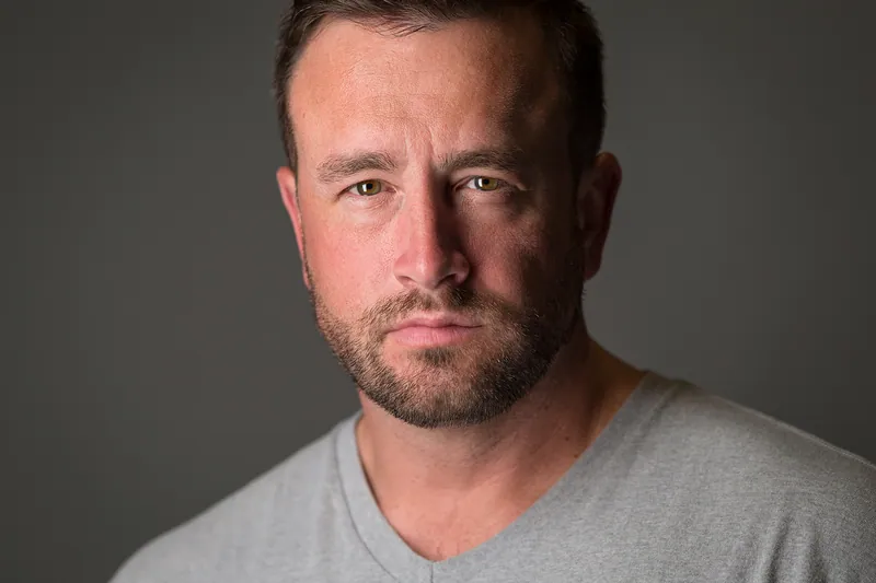
 By Joe Sale · Photographer & fine artist · Reviewed and updated October 2026
Good drone photography Tampa clients can actually use starts long before the propellers spin. The city is wrapped in water, ringed by airports and shaped by fast changing coastal weather, so the planning matters as much as the flying. Joe Sale is a professional photographer and fine artist based in Tampa Bay who shoots aerial stills and 4K video with a DJI drone, alongside his ground work with Nikon cameras.
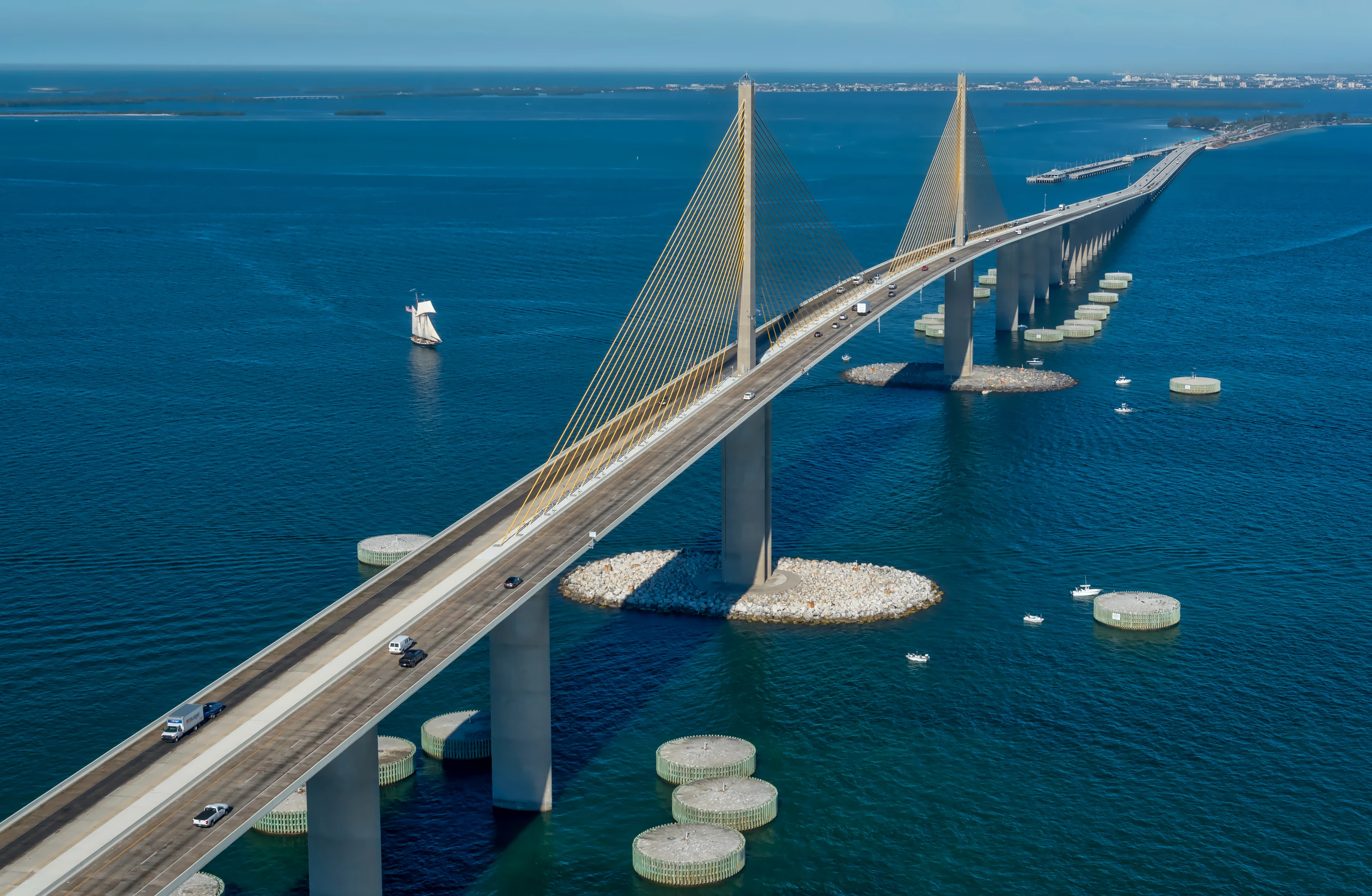
His aerial files include footage over downtown Tampa, views of the Sunshine Skyway and passes over St. Pete Beach beside the Don CeSar. This page explains how he approaches a flight, what you receive, and how aerials fit with the rest of a shoot. When you have a project in mind, start a booking request.
Joe Sale provides drone photography and 4K aerial video across Tampa for real estate, hospitality, restaurants, brands and campaigns. Each flight is planned around FAA Part 107 rules, local airspace and the weather, then paired with ground photography when useful. Edited files arrive in a private online gallery sized for web, social and print.
What Drone Photography Tampa Clients Actually Use
An aerial is only worth flying if it answers a question a ground photo cannot. Here are the questions Tampa clients usually bring.
- Where is this property, really? For listings, a raised view shows how close a home sits to the bay, a park or downtown. Pair it with interiors from the Tampa real estate photography page.
- What does the whole venue look like? Hotels, marinas and restaurants with outdoor space read better from above, where pools, docks and patios make sense together.
- How do we open the video? Brand campaigns often need an establishing shot, a slow push over the skyline or water before cutting to people and product.
- How big was the event? A single overhead frame of a crowd or a festival layout tells scale instantly, where permitted.
Each of these needs a slightly different flight. A listing calls for a handful of carefully chosen heights that show the roofline, the lot and the surroundings without distorting the home. A hospitality client may want a sunrise pass over the pool before guests appear. A campaign opener needs one long, steady move that an editor can trim to fit the music. Knowing the end use shapes the altitude, the angle and even the time of day.
If none of those apply, Joe will say so. Plenty of brand stories are better told at eye level, and the brand and commercial photography service covers that side. The aim is never aerials for their own sake. It is drone photography Tampa audiences notice because it shows them something new.
Rules, Airspace and Weather: The Planning Behind a Flight
Commercial drone work in the United States falls under the FAA's Part 107 rules. In practice, that means every job begins with questions about where, when and how high, and Joe plans each flight around airspace and weather before anything leaves the ground.
None of this is glamorous, and that is the point. Clients rarely see the research, only the result: a flight that happens on schedule, captures the agreed shots and ends without surprises. Responsible drone photography Tampa neighbors and businesses can live with also means respecting privacy, keeping clear of crowds and choosing launch spots that do not block sidewalks or docks.
Why Tampa airspace takes homework
Tampa is a busy place to fly. Tampa International Airport sits northwest of downtown, MacDill Air Force Base occupies the southern tip of the Interbay Peninsula, and Peter O. Knight Airport sits at the end of Davis Islands. On game days, stadium flight restrictions apply around Raymond James Stadium. Some locations need advance authorization and some are simply off limits, so part of planning is finding out which applies to your address.
Why the weather matters even more
Wind over open water is often stronger than it feels on land, and summer afternoons commonly bring a sea breeze and fast building thunderstorms. Joe watches forecasts closely and favors calmer mornings for flights that need steady footage.
- Confirm the location and what the client needs to see.
- Check the airspace and any temporary restrictions for that date.
- Study wind, cloud and storm timing.
- Plan the shot list so the battery time goes to the frames that matter.
- Scout a safe launch spot with a clear view of the aircraft.
- Keep a backup date in case conditions change.
That checklist sounds simple, yet skipping any step is how aerial shoots go wrong. A missed restriction can cancel a flight on the day. A missed wind forecast can turn smooth video into shaky footage. Building the plan first is what makes drone photography Tampa projects dependable rather than lucky.
Stills or 4K Video? Choosing Your Deliverables
The DJI drone Joe flies captures both high resolution stills and 4K video. Most projects benefit from one more than the other, and some need both. This comparison helps you decide what to ask for.
| Aerial stills | 4K aerial video | |
|---|---|---|
| Best for | Listings, websites, print, brochures | Brand films, social reels, listing tours |
| Strength | Precise composition, easy to crop and print | Movement, reveal shots, a sense of arrival |
| Flight style | Hovering at chosen heights and angles | Slow, smooth passes and pull backs |
| Ideal light | Clear morning or golden hour | Steady conditions with little wind |
| Pairs well with | Interior and exterior ground photos | Ground video and portrait stills |
A common combination for property and hospitality work is a set of stills from several heights plus a short clip that moves from the street toward the water. For campaign work, Joe can plan the aerial footage to cut cleanly with the ground shots he makes on the same day, so the edit feels like one story.
Thinking about where files will live
A listing site might want a horizontal hero frame with space above the roofline. A social reel needs vertical framing planned in advance, since cropping 4K footage from horizontal to vertical sacrifices a lot of the scene. Print brochures want stills with clean edges and no awkward cutoffs. Telling Joe where the work will appear lets him compose for each format during the flight, which is far better than fixing it in the edit. Good drone photography. Tampa marketing teams, in particular, appreciate files that arrive ready for every channel.
Tampa From Above: Places Joe Has Flown and Photographed
The most convincing way to judge an aerial photographer is to look at what they have already made. These are examples from Joe's own files.
Downtown Tampa
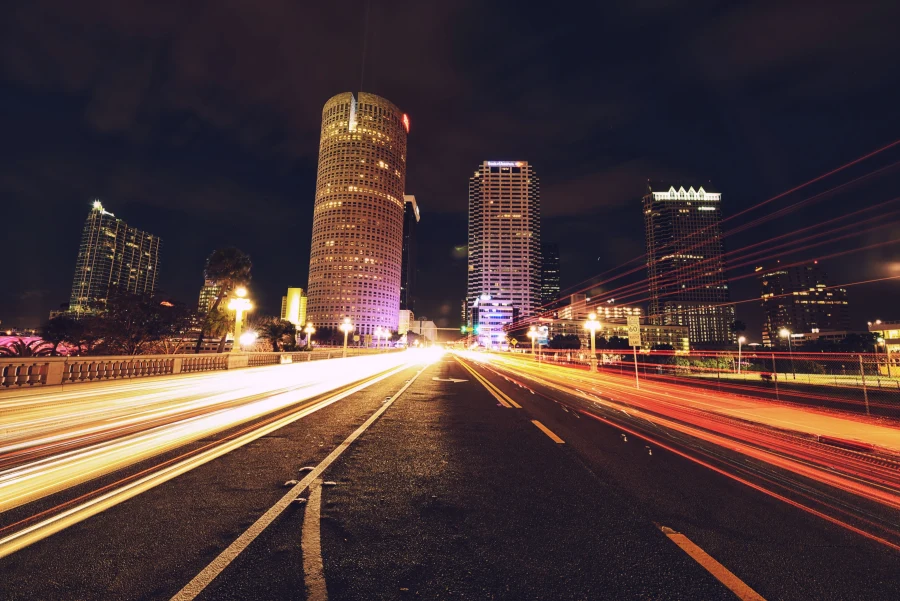
Joe's drone footage over downtown Tampa shows the grid of towers meeting the Hillsborough River, with the Riverwalk tracing the water's edge. From above, the river curves read as graphic lines, and reflections of the skyline change with every bit of breeze.
The Sunshine Skyway
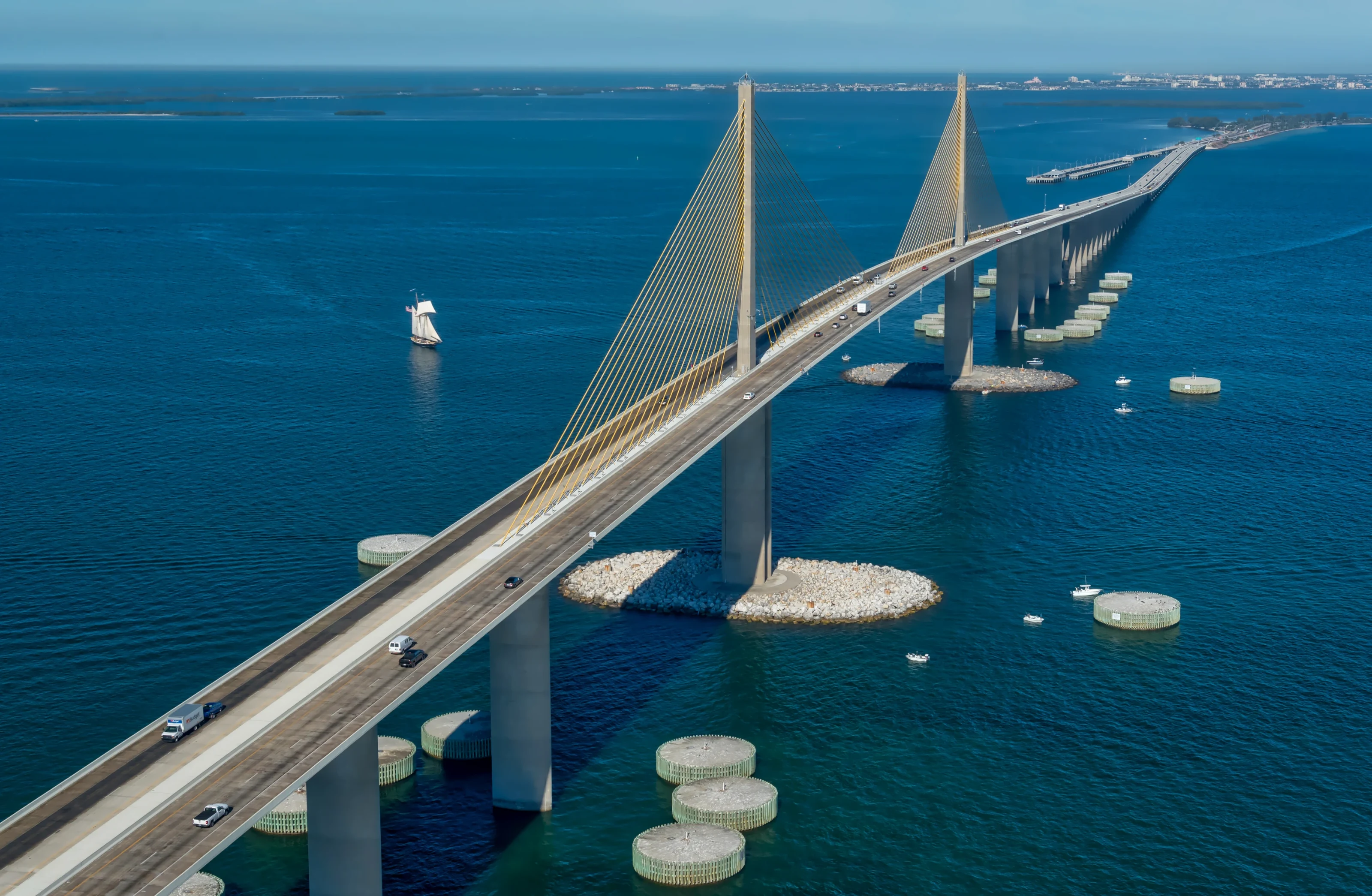
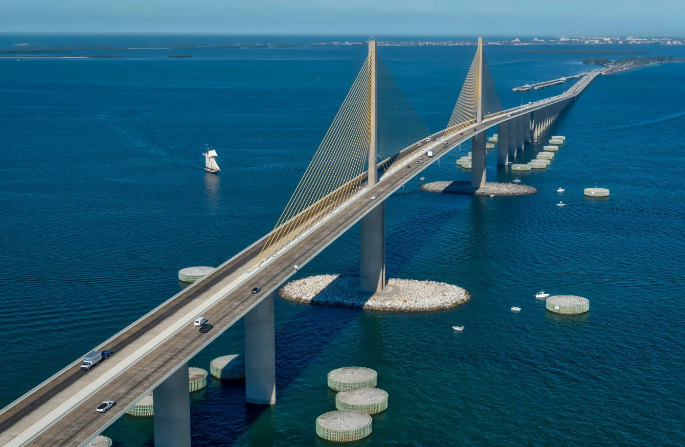
His aerials of the Sunshine Skyway capture the bridge's long approaches and cable stays stretching across the mouth of Tampa Bay. It is a subject that rewards patience, because the scale only reads when there is enough water and sky around the span. A boat crossing beneath the bridge or a band of low cloud can turn a good frame into the one that ends up on a wall.
St. Pete Beach and the Don CeSar
Across the bay, Joe has flown over St. Pete Beach beside the Don CeSar, where the pink hotel sits against white sand and Gulf water. More from that coastline lives on the St. Pete Beach photographer page. You can browse more aerial and ground work in the portfolio.
Other landmarks with strong aerial potential
Bayshore Boulevard's long, curving balustrade along Hillsborough Bay, the residential canals and marinas of Davis Islands, and the water around Harbour Island all offer striking patterns from above. Whether any of them can be flown on a given day depends on airspace and conditions, which is exactly why the planning step comes first. When a location works, these are the kinds of scenes that make drone photography Tampa viewers stop scrolling for.
Planning aerial coverage? Commercial drone flights in the United States fall under the FAA's Part 107 rules for commercial operators, and Joe checks the National Weather Service Tampa Bay forecast for wind and storms before every flight.
Ground Plus Air: Why One Photographer Should Shoot Both
Many projects need aerials and ground images together, and using one photographer for both keeps color, style and timing consistent. Joe's ground kit includes Nikon D5, D6 and D750 bodies, with lenses from the 14 to 24mm f/2.8 for wide interiors to the 80 to 400mm for compressed views of distant landmarks.
That range lets him photograph a waterfront restaurant's dining room, its plated dishes and its dock from the air within one visit. For a property, he can match a sweeping overhead frame with a tight detail of the entry and a dusk exterior from the street. The edit then reads as a single, coherent set rather than pieces from different vendors.
There is also a practical benefit. One person managing both perspectives can shoot the aerial at the best moment of light and spend the rest of the visit on the ground, rather than coordinating two crews with two schedules, two invoices and two different ideas of what the brand should look like. For small businesses especially, combining drone photography. Tampa restaurants, shops and offices can then use the same day's work across a website, social posts and print.
His fine art work shows the same thinking. A blue hour panorama of the downtown Tampa skyline over the Hillsborough River and long exposure light trails stacked from many frames come from ground positions chosen with the same care as any flight. That mix of perspectives is what gives drone photography Tampa projects context, because the air shot explains where you are and the ground shot explains why it matters.
Timing Drone Photography Tampa Shoots Around the Light
From the air, light behaves differently than on the street. There are no buildings to shade the scene and plenty of water to reflect the sky, so timing becomes the single biggest creative choice.
Early morning
Calm air, soft light and fewer people make mornings the default for steady footage and clean property shots. Water is often glassy, which gives mirror reflections of the skyline and bridges.
Golden hour and blue hour
Low sun rakes across rooftops and docks and makes textures pop. After sunset, the brief blue hour balances city lights with the evening sky, the same window Joe used for his downtown panorama.
Midday and summer haze
High sun flattens everything and summer humidity can add haze over the bay. Midday is sometimes useful for showing pool water and true colors, but it is rarely the first choice. In the drier months of late fall and winter, the air is often clearer and distant landmarks look sharper.
Seasonal planning at a glance
- October to April: drier air, clearer horizons and more stable mornings, generally the easiest season for drone photography Tampa shoots.
- May and June: rising heat and humidity, with afternoon storms becoming more frequent.
- July to September: peak storm season and part of hurricane season, so early starts and flexible dates are essential.
From Planning Call to Delivered Aerial Gallery
Every drone project with Joe follows the same core steps, adapted for the job.
- Planning call. You explain what the images need to show, where they will be used and any deadline that matters.
- Site and airspace research. Joe checks the location, the airspace and the forecast, and suggests a time window.
- Shot list. Together you agree on heights, angles and any video moves, so the flight is efficient and nothing important is left out.
- Flight and ground coverage. Joe flies the planned shots, then adds ground photography if it is part of the brief.
- Editing. Color, exposure and horizon lines are corrected by hand, and video clips are trimmed and graded.
- Delivery. Files arrive in a private online gallery sized for web, social and print.
The details of the aerial and drone service page go further on deliverable formats. If the job is part of a larger campaign, the Tampa commercial photographer guide shows how aerials slot in.
The editing stage deserves a word. Aerial images often need careful correction: horizons straightened, highlights on water pulled back, and color balanced so the bay looks like the bay rather than a cartoon. Joe edits each frame by hand with the same restraint he brings to portrait retouching, aiming for images that feel true to the place. That restraint is part of what separates considered drone photography. Tampa scenery is beautiful enough without heavy filters.
Prints, Portfolio and Next Steps
Some people find Joe's aerial work through his art rather than his commercial services. Limited fine art prints of Tampa Bay scenes, including the skyline and the bay, are available through the print shop and the dedicated Tampa skyline photo prints collection. A view of home from above can be a striking piece for an office lobby or living room.
The prints come from the same instinct that drives his commercial flights: patience for the right light and a willingness to come back when it is not right yet. The Sunshine Skyway, the downtown skyline and the Gasparilla pirate ship and flotilla are all part of the Tampa Bay story he keeps returning to with the camera.
For the wider picture of what Joe shoots across the city, from headshots to concerts, visit the photographer in Tampa page. You can follow new work on Instagram at @jsalephotography, which is a good place to see recent aerial and ground work from around the bay before you book.
Ready to talk about drone photography Tampa projects of your own? Call or text Joe at 813-417-2626, or send the location, goals and preferred dates through the booking form, and he will come back with a plan for the flight.
Drone Photography Tampa: Frequently Asked Questions
Do you need FAA approval for drone photography in Tampa?
Commercial drone work in the United States falls under FAA Part 107 rules, and certain locations near airports and military bases require advance authorization or are restricted. Tampa has several, including areas near Tampa International Airport and MacDill Air Force Base. Joe plans each flight around airspace and weather and will tell you early if a location raises issues.
Can a drone fly over downtown Tampa?
Downtown Tampa sits in busy airspace, so whether a flight is possible depends on the exact location, the date and current rules. Joe has drone footage over downtown Tampa in his own files, and each new request starts with checking the airspace and any temporary restrictions for that specific address and time window before anything is promised.
What is the best time of day for aerial photos in Tampa?
Early morning usually gives the calmest wind, softest light and glassy water, which suits both stills and smooth video. Golden hour adds warmth and texture, and the short blue hour after sunset balances city lights with the sky. Midday is harsh and summer afternoons often bring sea breezes and storms.
Is drone video included with aerial photography?
It can be, depending on what you need. Joe's DJI drone records both high resolution stills and 4K video, so a single flight can capture a set of property or venue photos plus clips for social media or a brand film. Talk through your goals on the planning call and the shot list will cover both.
Can you combine drone shots with regular photography?
Yes, and it usually makes the strongest set. Joe photographs interiors, exteriors, food, people and products with Nikon cameras on the same visit as the flight, so color and style match across the whole gallery. Real estate, restaurants, hotels and brand campaigns benefit most from that mix of aerial context and close detail.
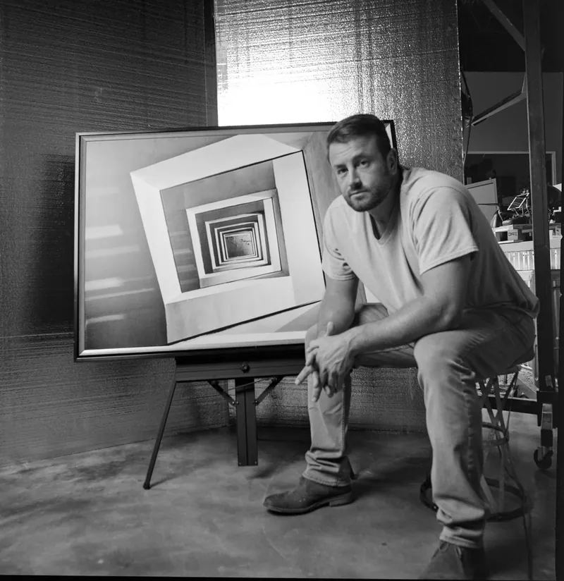
About Joe SaleJoe is a Tampa Bay photographer and fine artist who shoots portraits, live music, brands and the city itself. See more on the about page, browse the portfolio or book a shoot.