
 By Joe Sale · Photographer & fine artist · Reviewed and updated October 2026
Good St. Pete drone photography starts with a simple fact about the city: it is almost surrounded by water. Tampa Bay runs along its eastern edge, the Gulf beaches sit to the west, and bridges, marinas and causeways connect it all. From the ground you see a street. From the air you see a peninsula, and that view explains a place in a way nothing else can.
Joe Sale is a Tampa Bay photographer and fine artist who flies a DJI drone for stills and 4K video. He has already filmed over St. Pete Beach by the Don CeSar and photographed the Sunshine Skyway from above, and he pairs that aerial work with ground photography so a single project can tell the whole story.
Joe Sale offers St. Pete drone photography for real estate, hospitality, brands, events and fine art, delivering aerial stills and 4K video. Commercial drone work in the US falls under FAA Part 107 rules, and Joe plans each flight around airspace and weather, then delivers edited files in a private online gallery.
What St. Pete Drone Photography Reveals That the Ground Cannot
Most places look best at eye level. St. Petersburg is different. The city's character comes from how land meets water: the waterfront parks curving along the bay, the long reach of the St. Pete Pier, the barrier islands strung along the Gulf, and the bridges that stitch them together. None of that fits in a frame taken from a sidewalk.
An aerial view does three things a ground photo struggles with. It shows relationships, such as how close a home sits to the water or how a hotel connects to its beach. It shows scale, the size of a property, a crowd or a stretch of shoreline. And it shows pattern, the geometry of marinas, the color bands of shallow Gulf water, the grid of downtown streets meeting a ragged coast.
That is why St. Pete drone photography is so often the image people remember from a listing, a website or a campaign. It is the establishing shot, the one that tells a viewer where they are before anything else happens.
Aerials also change how people read a neighborhood. Old Northeast, the downtown core and the waterfront parks look like separate places at street level. From a few hundred feet up they become one connected shoreline, with the Pier reaching out into the bay as a natural focal point. That sense of connection is often what a client is really trying to sell, whether the product is a home, a hotel room or a city brand.
Airspace on a Peninsula: Planning Every Flight
Flying over St. Petersburg takes more planning than flying over an open field. Albert Whitted Airport sits right on the downtown waterfront, with its runway right beside the bay, St. Pete-Clearwater International Airport serves mid Pinellas, and the wider bay has its own mix of controlled airspace. Busy beaches, boats and events add more to think about.
People on the ground matter as much as aircraft in the sky. Beaches, parks and waterfront events draw crowds, and responsible flying means keeping the drone clear of them. That often pushes flights toward quieter hours, which conveniently line up with the softest light of the day.
Commercial drone work in the US falls under FAA Part 107 rules. Joe plans each flight around airspace and weather before the shoot, which means checking where the drone can legally operate, whether authorization is needed for a particular spot, and how close people and traffic will be. If a planned angle is not possible, he will suggest one that is, or a ground based alternative that still tells the story.
This planning is not a box to tick. It shapes the shot list. A brief that says show the hotel with the downtown skyline behind it might become a slightly different angle from a slightly different place, and knowing that early keeps the project on schedule.
It also explains why reliable St. Pete drone photography is rarely a same day request. Building in time for airspace checks, a weather window and a backup date protects the result. If your project has a hard deadline, such as a listing going live or a campaign launch, mention it on the first call so the schedule works backward from that date.
A note on what Joe does not claim: he plans flights carefully and follows the rules that apply, but this page does not make promises about specific permissions in advance. Each location is checked on its own merits, and the plan is built from what that check shows.
Wind, Glare and Storms Over Open Water
Weather on the Pinellas peninsula changes fast, and water amplifies every change. Here is what Joe watches before a flight.
- Wind off the Gulf and the bay. Breezes tend to be stronger over open water than inland. Calm mornings are often the most reliable flying window.
- Summer thunderstorms. From late spring into early fall, afternoon storms build quickly. Morning flights or early evening flights after a storm passes are usually safer bets.
- Sun angle and glare. Midday sun can turn the water into a white sheet. Lower sun brings out color and texture in the shallows.
- Haze. Humid days soften distant detail, which can be beautiful for mood but less ideal when a client wants a crisp skyline.
Temperature plays a role too. Hot summer afternoons are hard on batteries and on anyone standing on a sunny seawall, so early starts are common in the warmer months. Winter mornings are often crisp and clear, which is ideal for long views across the bay toward Tampa.
Because conditions can shift overnight, aerial bookings carry a little flexibility. Joe will talk through a backup window during planning so a breezy morning does not derail the whole project.
Reading the water
Water color around Pinellas shifts with the tide, the sun and the season. On clear days the Gulf shallows off the beaches can show distinct bands of turquoise and green, while the bay side often reads deeper and bluer. Wind ripples catch light and add sparkle; dead calm gives mirror reflections of hotels and boats. Each condition suits a different kind of image, and part of the craft in St. Pete drone photography is choosing the morning that matches the story.
Who Books St. Pete Drone Photography
The reasons clients ask for aerials in St. Petersburg tend to fall into a few groups. Each one needs a slightly different approach from the air.
Waterfront real estate
For homes and condos near the water, the aerial answers the first question every buyer asks: how close is the water, really? A high shot shows the property, the dock, the canal or bay beyond and the neighborhood around it. Joe also photographs interiors and exteriors from the ground, which the St. Petersburg real estate photography page covers in detail.
Hotels, restaurants and hospitality
Beach hotels and waterfront restaurants sell a location as much as a room or a plate. Aerials frame the property against the Gulf or the bay, then ground images bring guests inside. The brand and commercial photography service handles the ground half of that story.
Marinas and boats
St. Petersburg's marinas are full of strong shapes: rows of slips, white hulls and the dark water between them. From above, they turn into graphic patterns that work for yacht services, waterfront developments and anyone whose business lives on the water.
Events
Festivals, races and gatherings along the waterfront look very different from above, where the size of a crowd and the layout of a site become clear. Airspace and crowd rules apply, so event flights need extra lead time.
Brands and campaigns
A brand rooted in St. Pete can use aerials as visual signatures: coastline, color and light that viewers recognize instantly. The St. Petersburg commercial photographer page shows how that fits into a larger campaign.
Construction and progress
Builders and developers sometimes want a site captured from the same position at intervals, so investors and buyers can watch a project rise. Repeat flights from a consistent angle make that comparison easy. Discuss the schedule at the start so each visit can be planned around the conditions of the day.
Planning aerial coverage? Commercial drone flights in the United States fall under the FAA's Part 107 rules for commercial operators, and Joe checks the National Weather Service Tampa Bay forecast for wind and storms before every flight.
Flights Joe Has Already Made Around Pinellas
The best way to judge a drone photographer is by what they have already flown. Joe's aerial work around this side of the bay includes:
- St. Pete Beach and the Don CeSar. Drone footage over the beach by the famous pink hotel, showing how it sits between the Gulf and the rest of the island.
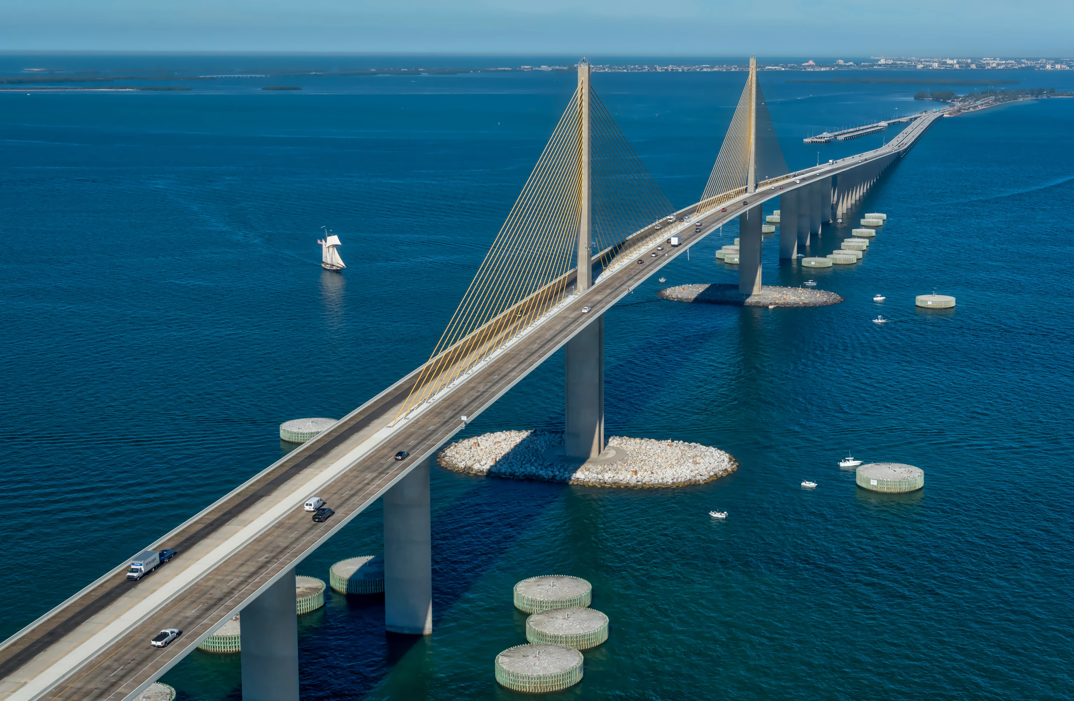
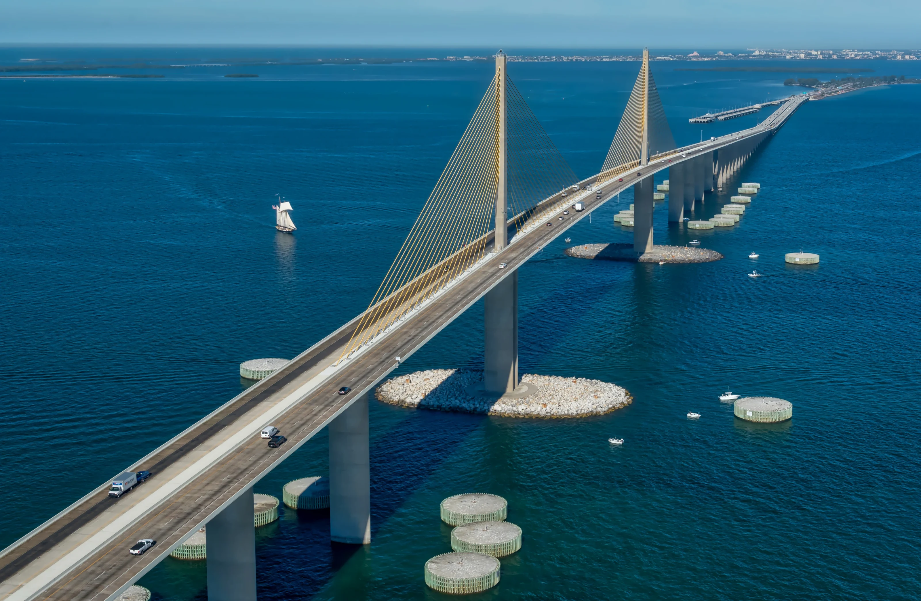
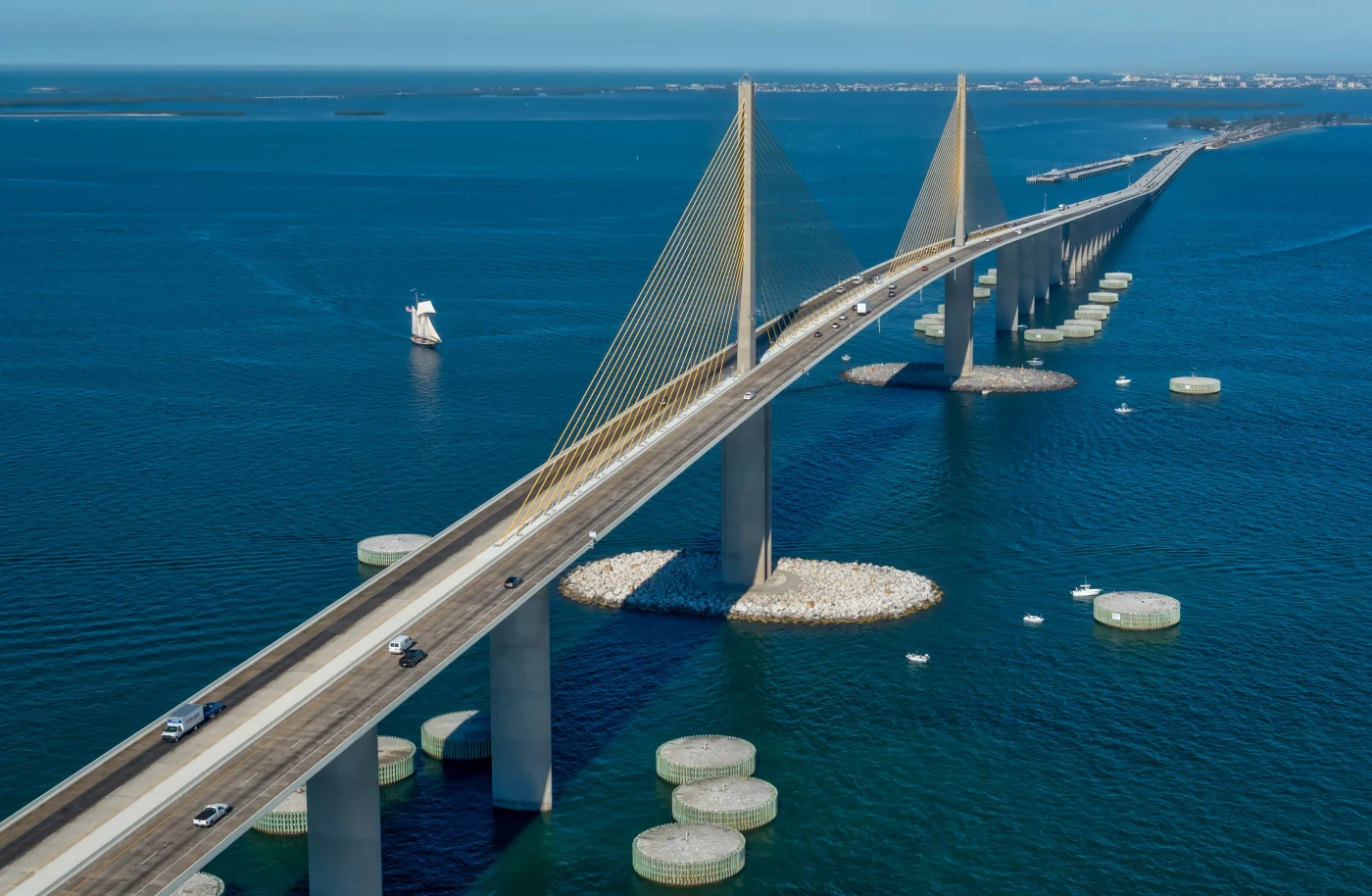
- The Sunshine Skyway. Aerial images of the bridge that links Pinellas to Manatee County across the mouth of Tampa Bay.
- Downtown Tampa across the bay. Footage over the downtown skyline and river, which gives Joe practice framing dense city architecture from above.
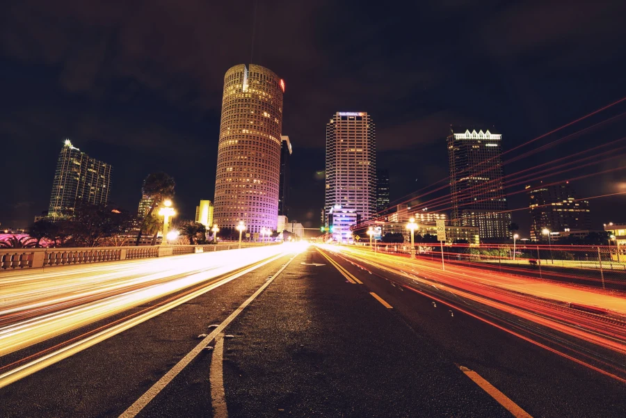
Alongside the drone work, Joe makes ground based images that inform how he sees from the air: shutter drag Gulf sunsets, long exposure light trails and a blue hour skyline panorama over the Hillsborough River. That fine art practice teaches patience with light, which is the same patience an aerial shot needs.
Experience over the Skyway in particular translates well to St. Pete projects. Bridges, open water and wind all demand careful positioning, and a long structure crossing a wide bay teaches how to keep lines clean and horizons level. Those lessons carry straight into framing a hotel against the Gulf or a waterfront home against the bay.
None of these were shot to fill a brochure. They came from the same curiosity that drives a commissioned project: finding the angle that makes a familiar place look new. That habit is what you are hiring when you bring Joe in to fly your site, along with his attention to the light that makes it worth looking at.
You can see more on the portfolio page and on Instagram at @jsalephotography.
Stills, 4K Video or Both: Choosing St. Pete Drone Photography Deliverables
Aerial projects usually produce two kinds of files, and they serve different jobs. Deciding up front what you need keeps flight time focused.
| Deliverable | Best used for | Things to decide |
|---|---|---|
| Aerial stills | Listings, websites, brochures, large prints | Which angles, which heights, how many views of the property |
| Short 4K clips | Social posts, website headers, short promos | Movement style, such as a slow reveal, a push forward or an orbit |
| Aerial plus ground stills | Hospitality, real estate, brand campaigns | Matching color and mood across both sets |
| Fine art aerials | Wall art for homes and offices | Composition and print size |
Joe edits the stills for color and clarity and delivers everything through a private online gallery sized for web, social and print. If you plan to use video in a larger edit, mention that during planning so the clips are shot with room for cutting.
A quick rule of thumb for St. Pete drone photography: if the image needs to work on a phone, think about vertical crops; if it needs to work on a wall, think about the cleanest, simplest composition.
One flight can cover both, but only if the shot list says so in advance. Joe will help you think through those formats, and he keeps a few frames loose and wide so designers have room for text when the image lands on a web page or brochure.
Planning St. Pete Drone Photography Step by Step
Here is how a typical aerial booking moves from first message to finished files.
- Send a request. Use the booking page and describe the site, its address area and how the images will be used.
- Planning call. Joe asks about the goal, the must have angles and any deadlines.
- Airspace and weather check. Joe checks the location against airspace rules and the forecast, then proposes a flight window and a backup.
- The flight. On the day, Joe confirms conditions on site, flies the planned shots and adds any good surprises.
- Ground coverage. If booked, he photographs the property, people or product from the ground in the same visit.
- Editing and delivery. Files arrive in a private online gallery, ready to download.
For more on how Joe approaches aerial work across the region, see the aerial and drone service page and the Tampa drone photography guide. If your property sits farther north on the Gulf, the Clearwater drone photography page covers that stretch of coast.
Throughout the process you deal with one person. The same photographer who plans the airspace also flies the drone, shoots the ground images and edits the files, which keeps decisions quick and the look consistent from the first frame to the last.
Aerial Views That Belong on a Wall
Not every aerial is commercial. Some of the most striking images of the bay are simply beautiful: the turquoise shallows off the beaches, a bridge cutting across open water, a city glowing at dusk. Joe is a fine artist as well as a working photographer, and his limited fine art prints of Tampa Bay include work made from the air and the ground.
If you own a waterfront home or business, a commissioned aerial of your own place can become a one of a kind print.
Aerial compositions tend to read as abstract at a distance and reveal detail up close, which makes them especially satisfying at large sizes. Joe can suggest which frames have the sharpness and simplicity to hold up as wall art, and how St. Pete drone photography from your own project might sit beside a skyline or sunset print from his collection.
When you are ready to talk about a project, start on the booking page or explore the wider St. Petersburg photographer page for everything Joe offers in the city.
St. Pete Drone Photography: Frequently Asked Questions
Can you fly a drone in downtown St. Petersburg?
Downtown St. Pete sits close to Albert Whitted Airport, so flights there need careful airspace planning. Commercial drone work in the US falls under FAA Part 107 rules, and Joe checks airspace and weather before every flight. Some angles may need authorization or a different launch point, and Joe will explain what is possible during planning.
What is St. Pete drone photography used for?
The most common uses are waterfront real estate, hotels and restaurants, brand campaigns and events. Aerials show how a property relates to the water, the size of a site and the character of the coastline. Many clients pair aerial stills or 4K clips with ground photography so the full set tells one consistent story.
Do you shoot drone video as well as photos?
Yes. Joe's DJI drone captures 4K video as well as still images. Short clips work well for social posts and website headers, while stills suit listings and prints. During planning, you decide the mix, and Joe shapes the flight around the shots you need most. If the clips will be cut into a longer video by an editor, say so early so each move is flown with a clean start and finish.
What happens if the weather is bad on the day?
Wind, storms and low cloud can all ground a flight, especially over open water. Joe watches the forecast and plans a backup window during the planning call. If conditions are not safe or will not produce good images, the flight moves to that backup rather than going ahead in poor conditions.
Can you photograph Gulf beach properties too?
Yes. Joe has already flown over St. Pete Beach near the Don CeSar, and beach hotels, restaurants and homes are a natural fit for aerials. Busy beaches mean extra attention to people below and to timing, so early mornings are often the best choice for beachfront flights. Those hours also bring softer light on the sand and calmer water along the shore.

About Joe SaleJoe is a Tampa Bay photographer and fine artist who shoots portraits, live music, brands and the city itself. See more on the about page, browse the portfolio or book a shoot.